


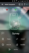
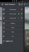
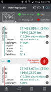
Mobile Topographer Free

Mobile Topographer Free介绍
Your mobile Topographer!
The leading tool for the professional surveyor or anyone who wants to mark his property, offering the best accuracy and extensive functionality that no other app can!
*** Increase GPS accuracy using:
- Weighted averaging (on every axis).
- Map calibration.
- Device calibration on map, or on a know point.
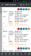
*** Display and convert GPS geodetic to Cartesian EN coordinates and back:
- UTM.
- Europe ETRS89/UTMZ28-38.
- Hellas HGRS 87 (EGSA 87).
- Hellas HGRS 87 - HEPOS.
- Hellas HTRS07/TM07.
- Iceland ISN93/Lambert 93.
- Morocco Merchich.
- SPCS83 (124 zones) USA.
- Romania S-42(58)/Stereo 70.
- Lebanon & Syria Deir ez Zor/Stereo.
- Croatia HTRS96/TM.
- Serbia SRB-ETRS89/UTM, SRB-MGI/Z7.
- Australia MGA94 (GDA94), AMG66 (AGD66) National, A.C.T., Northern Territory, NSW & Victoria, Tasmania,AMG84 (AGD84).
- Former FR of Yugoslavia MGI Balkans zones 5,6 & 7.
- Italy Monte Mario West Zone 1 Peninsular, West Zone 1 Sardinia, East Zone 2 Peninsular, East Zone 2 Sicily.
- Costa Rica CΜ05/CRTM05, Ocotepeque 1935 Costa Rica Norte & Ocotepeque 1935 Costa Rica Sur.
- Cyprus CGRS-93-LTM.
- Hungary HD72/EOV.
- Kosovo KosovaREF01.
- Latvia LKS92/TM.
- Lithuania LKS94/TM.
- Spain ED50/UTMZ29-30 NW, ED50/UTMZ29-31 ML & ED50/UTMZ31 BA.
- Uk's OSTN02/OSGM02.
- Turkey ED50/Gauss-Kruger 3° Z9-15, ITRF96 & ED50/UTMZ35-38.
- Luxembourg LUREF.
- Venezuala REGVEN/Z18-20.
- Sweden SWEREF99 TM.
- Argentina POSGAR 94 & POSGAR 2007.
- India Kalianpur 1975 ZI - ZIV.
- Algeria Nord Sahara 1959 / Z29-32.
- Armenia, Georgia, Azerbaijan, Estonia, Latvia, Lithuania, Russia - Kaliningrad and Kazakhstan Pulkovo 1942/ CS63 (A)Z1-4, (C)Z0-2, (K)Z2-4.
- Central and South America SIRGAS 2000.
- Nigeria and Cameroon Minna 1996 & 2008 MTM West, Mid, East Belts & UTM Z31-33.
- Bangladesh Gulshan 303/TM.
- France RGF93/CC42-50.
- Canada CSRS
- Egypt 1907 Blue, Red, Purple, Extended Purple belts.
- Portugal ETRS89/PTM06.
- Netherlands Amersfoort/RD new.
- Qatar QND95.
- Colombia MAGNA-SIRGAS Far West, West, Bogota, Central East, East zones.
- Mexico ITRF 2008/LCC.
- Madagascar Tananariva (Paris)/Laborde & Tananariva/UTM Z38-39S .
- Tunisia Carthage (Paris)/Mining Grid, Carthage/Nord, Carthage/Sud, Carthage/TM 11 NE, Carthage/UTM zone 32N.
- Liechtenstein CH1903/LV03C-G.
- Switzerland CH1903/LV03 (old), CH1903+/LV95 (new).
- Brazil SAD69/UTM Z18-25 & SAD69(96)/UTM Z18-25
- Spain Canary Islands REGCAN95/LAEA & REGCAN95/LCC & REGCAN95/UTM Z27-28
*** Auto stop for accurate positioning.
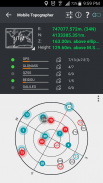
*** Examine the satellites above you in a sky view.
*** Signal strength and number of satellites indication for each GNSS constellation individually.
*** Multiple units support:
- Meters,
- International feet,
- US survey feet.
***Height calculation:
- Ellipsoidal height.
- EGM96 orthometric height calculation.
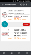
*** Convert from geodetic to Cartesian coordinates and back:
- Support for device measured points, or
- Manually input of geodetic or Cartesian coords.
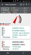
*** Drive me:
- Key in coordinates of the target point in either geodetic or Cartesian coordinates, or select a point from the list and follow the pointer.
- Compass indicating both magnetic and true North.
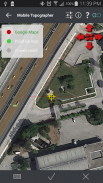
*** Project on Map:
- Project individual points on any map application.
- Project list of points, and the defined polygon, on embedded maps.
*** Save multiple point lists, to use them later.
*** Calculate area.
*** Export point lists το:
- .txt (text file)
- .csv (point file - comma separated)
- .kml (google earth file)
- .gpx (Gps Exchange format)
- .dxf (drawing file)
*** Send file via e-mail, or upload it to cloud.
*** Complete help text support.
Help us improve Mobile Topographer by e-mailing your comments and suggestions.
TAGS: Survey Surveyor Property GPS GNSS GLONASS QZSS BEIDOU GALILEO
您的移动角膜地形图!
对于专业测量师或谁想要,以纪念他的财产的人主导工具,提供最佳的精度和丰富的功能,没有其他的应用程序就可以了!
使用***增加GPS精度:
- 加权平均(每个轴)。
- 地图校准。
- 设备标定地图,或在知道点。
***显示和转换GPS大地测量到笛卡尔坐标EN和背部:
- UTM。
- 欧洲ETRS89 / UTMZ28-38。
- 希腊HGRS 87(EGSA 87)。
- 希腊HGRS 87 - HEPOS。
- 希腊HTRS07 / TM07。
- 冰岛ISN93 /兰伯特93。
- 摩洛哥Merchich。
- SPCS83(124区),USA。
- 罗马尼亚S-42(58)/立体声70。
- 黎巴嫩与叙利亚代尔祖尔/立体声。
- 克罗地亚HTRS96 / TM。
- 塞尔维亚SRB-ETRS89 / UTM,SRB-MGI / Z7。
- 澳大利亚MGA94(GDA94),AMG66(AGD66)国家,A.C.T.,北领地,新南威尔士州和维多利亚州,塔斯马尼亚州,AMG84(AGD84)。
- 南斯拉夫MGI巴尔干地区5,6和7前FR。
- 意大利Monte Mario山西区1半岛,西1区撒丁岛,东区2半岛,东2区西西里岛。
- 哥斯达黎加CΜ05/ CRTM05,奥科特佩克1935哥斯达黎加北部与奥科特佩克1935哥斯达黎加苏尔。
- 塞浦路斯CGRS-93-LTM。
- 匈牙利HD72 / EOV。
- 科索沃KosovaREF01。
- 拉脱维亚LKS92 / TM。
- 立陶宛LKS94 / TM。
- 西班牙ED50 / UTMZ29-30 NW,ED50 / UTMZ29-31 ML&ED 50 / UTMZ31学士学位。
- 英国OSTN02 / OSGM02。
- 土耳其ED50 /高斯 - 克鲁格3°Z9-15,ITRF96和ED50 / UTMZ35-38。
- 卢森堡LUREF。
- Venezuala REGVEN / Z18-20。
- 瑞典SWEREF99 TM。
- 阿根廷POSGAR 94年和2007年POSGAR。
- 印度Kalianpur 1975年ZI - ZIV。
- 阿尔及利亚撒哈拉北1959 / Z29-32。
- 亚美尼亚,格鲁吉亚,阿塞拜疆,爱沙尼亚,拉脱维亚,立陶宛,俄罗斯 - 加里宁格勒和哈萨克斯坦普尔科沃1942 / CS63(A)Z1-4,(C)Z0-2,(K)Z2-4。
- 中美洲和南美洲制订战略2000
- 尼日利亚和喀麦隆明娜1996年暨2008年MTM西,中,东腰带及UTM Z31-33。
- 孟加拉国高尔杉303 / TM。
- 法国RGF93 / CC42-50。
- 加拿大CSRS
- 埃及1907蓝,红,紫,紫延长皮带。
- 葡萄牙ETRS89 / PTM06。
- 荷兰阿默斯福特/ RD新。
- 卡塔尔QND95。
- 哥伦比亚MAGNA-制订战略远西,西,波哥大,环东,东部区域。
- 墨西哥ITRF 2008 / LCC。
- 马达加斯加Tananariva(巴黎)/拉博德及Tananariva / UTM Z38-39S。
- 突尼斯迦太基(巴黎)/挖掘网格,迦太基/北部,迦太基/南基,迦太基/ TM 11 NE,迦太基/ UTM区32N。
- 列支敦士登CH1903 / LV03C-G。
- 瑞士CH1903 / LV03(旧),CH1903 + / LV95(新)。
- 巴西SAD69 / UTM Z18-25及SAD69(96)/ UTM Z18-25
- 西班牙加那利群岛REGCAN95 / LAEA与REGCAN95 / LCC和REGCAN95 / UTM Z27-28
***自动停机精确定位。
***检查在天空视野你上面的卫星。
***信号强度和卫星适应症每个单独的全球导航卫星系统星座的数量。
***多台设备支持:
- 米,
- 国际脚,
- 美国测量英尺。
***身高计算:
- 椭球的高度。
- EGM96正高计算。
***从大地到笛卡尔坐标和背部转换:
- 对于装置测量的支持点,或
- 大地坐标或笛卡尔COORDS手动输入。
*** 使我变得:
- 主要在两种大地坐标或笛卡尔坐标目标点的坐标,或从列表中选择一个点,并按照指针。
- 指南针指示磁性及真北。
*** 地图项目:
- 在任何地图应用项目各个点。
- 点的项目列表,并且所定义的多边形,在嵌入的地图。
***保存多点名单,后来使用它们。
***计算面积。
***出口点列表το:
- .TXT(文本文件)
- .CSV(点文件 - 逗号分隔)
- .KML(谷歌地球文件)
- 。GPX(GPS交换格式)
- .DXF(图形文件)
***通过电子邮件发送文件,或上传到云。
***完整的帮助文本支持。
帮助我们通过电子邮件发送您的意见和建议,提高移动角膜地形图。
标签:调查测量师地产GPS全球导航卫星系统GLONASS QZSS北斗GALILEO


